
Volcanoes in Iceland
Iceland is one of the most volcanically active countries on Earth. It has about 30 active volcanic systems, and in historical times – the last 1,100 years – there has been an eruption on average roughly every five years. Eruptions have shaped the land, the nation's history and everyday life.
Why are there so many eruptions in Iceland?
Iceland lies on the Mid-Atlantic Ridge, where the North American and Eurasian plates are moving apart by almost two centimetres a year. Beneath the country there is also a mantle plume carrying hot material up from deep within the Earth. Together these cause magma to reach the surface far more often than elsewhere along the ocean ridges. The volcanic zone runs diagonally across the country, from Reykjanes in the southwest north through Langjökull and Vatnajökull to Öxarfjörður in the north.
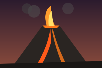
Types of eruption
Eruptions in Iceland are extremely varied. Geologists distinguish several main types:
- Fissure eruptions occur along long eruptive fissures. Laki and Eldgjá are examples of enormous fissure eruptions.
- Shield eruptions are long-lived lava eruptions from a single vent that build broad, gently sloping shields, such as Skjaldbreiður.
- Explosive eruptions happen when gas-rich magma, or magma and water, meet; they produce tephra and ash plumes.
- Subglacial eruptions melt the ice and often cause glacial floods (jökulhlaup), as at Grímsvötn and Katla.
- Submarine eruptions can create new islands, such as Surtsey south of the Westman Islands.
The best-known volcanoes
Hekla
Hekla in South Iceland is the country's most famous volcano. In the Middle Ages many Europeans believed it was the entrance to hell. Hekla has erupted at least twenty times since the settlement; the first recorded eruption was in 1104 and the most recent in 2000. The mountain is about 1,491 metres high.
Katla
Katla lies beneath the Mýrdalsjökull glacier and is one of Iceland's most dangerous volcanoes because of the huge glacial floods that accompany its eruptions. The last major eruption was in 1918. Katla is closely monitored, as an eruption could come at any time.
Grímsvötn
Grímsvötn in Vatnajökull is the most active volcano in the country. It erupted in 1996 (at Gjálp), 1998, 2004 and 2011, among other years. The 2011 eruption was the most powerful at Grímsvötn in more than a century.
Eyjafjallajökull
The eruption of Eyjafjallajökull in spring 2010 attracted worldwide attention when its ash cloud paralysed air traffic in Europe for several days. Hundreds of thousands of flights were cancelled and the volcano's name was on everyone's lips – even if few foreigners could pronounce it.
Askja and Bárðarbunga
A large explosive eruption at Askja in 1875 led to the formation of the Víti crater and the lake Öskjuvatn. The eruption caused great hardship in East Iceland and contributed to Icelandic emigration to North America. At Holuhraun, part of the Bárðarbunga volcanic system, an eruption in 2014–2015 produced the largest lava field in Iceland since the Laki fires.
Major eruptions in Iceland's history
| Year | Eruption | Consequences |
|---|---|---|
| c. 934–940 | Eldgjá | The largest lava eruption on Earth in historical times |
| 1104 | Hekla | Settlement in Þjórsárdalur was abandoned |
| 1362 | Öræfajökull | The largest explosive eruption in Iceland in historical times |
| 1783–1784 | Laki fires (Skaftáreldar) | The Haze Famine; about a fifth of the population died |
| 1918 | Katla | A huge glacial flood across Mýrdalssandur |
| 1963–1967 | Surtsey | A new island rose from the sea |
| 1973 | Heimaey | Lava flowed over part of the town in the Westman Islands |
| 2010 | Eyjafjallajökull | Air traffic in Europe was paralysed |
| 2014–2015 | Holuhraun | About 85 km² of lava |
| 2021– | Reykjanes Peninsula | Repeated eruptions at Fagradalsfjall and the Sundhnúkur crater row |
The Laki fires and the Haze Famine
The Laki fires (Skaftáreldar) began on 8 June 1783 when a fissure about 25 km long opened near the mountain Laki. Over eight months about 15 cubic kilometres of lava poured out, together with huge amounts of sulphur dioxide and fluorine. The gases poisoned the grass and killed livestock on a massive scale. The Haze Famine (Móðuharðindin) followed, and about a fifth of the population died of hunger and disease. The haze also spread to Europe and caused unusual weather there. Reverend Jón Steingrímsson delivered his famous "fire sermon" at Kirkjubæjarklaustur on 20 July 1783, and according to tradition the lava stopped just short of the church.
The Reykjanes eruptions
After a break of about 800 years, a new period of eruptions began on the Reykjanes Peninsula in 2021 with an eruption at Geldingadalir by Fagradalsfjall. There were further eruptions there in 2022 and 2023. In November 2023 the town of Grindavík had to be evacuated because of a magma intrusion beneath it, and since December that year there have been repeated eruptions along the Sundhnúkur crater row. Scientists consider it likely that volcanic activity on the peninsula could continue, with pauses, for decades or even longer.
Monitoring and civil protection
The Icelandic Meteorological Office monitors the country's volcanoes around the clock using seismometers, GPS measurements, gas sensors and satellite data. The Department of Civil Protection coordinates the response to natural hazards. When an eruption is imminent, warnings and aviation colour codes are issued. Visitors should always check conditions on the Met Office website and follow the authorities' instructions on closures.
Frequently asked questions
What is Iceland's most active volcano?
Grímsvötn in Vatnajökull is the most active volcano in the country and has erupted more often than any other in historical times.
When did Hekla last erupt?
Hekla last erupted in 2000. Before that it erupted in 1991, 1980–1981 and 1970.
Is it dangerous to travel to Iceland because of eruptions?
Generally not. Eruptions are closely monitored and hazardous areas are closed. It is important to follow civil protection guidance and check conditions on the Met Office website.